

Why Israel secretly decided to erase the Green Line
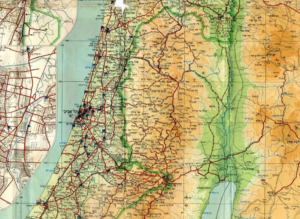
A map of Israel from 1964
Adam Raz writes in Haaretz on 9 September 2022:
A media storm sprang up last month over the decision by the Tel Aviv Municipality to hang in the city’s classrooms maps of Israel showing the Green Line – the armistice line that Israel and its neighbors agreed upon in 1949, following Israel’s War of Independence. Until 1967, that line signified Israel’s de facto eastern border and demarcated its sovereign territory. The line has not appeared on the State of Israel’s official maps throughout all the years of the occupation, and deliberately so, in the wake of secret decisions made by the security cabinet at the end of 1967. Instead of the Green Line, it was decided to denote Israel’s (unofficial) borders via the cease-fire lines of the Six-Day War fought in June of that year, encompassing the territories of the West Bank (including East Jerusalem), the Gaza Strip, the Sinai Peninsula and the Golan Heights.
Since then, the official maps printed by the Survey of Israel, a government agency, haven’t distinguished between the territory of the state as it was on the eve of the 1967 war and what it comprised afterward. In practice, as a glimpse at the official map shows, Israel (just such: not “State of” and not “Land of”) stretches from the Mediterranean Sea, in the west, to the Jordan River, in the east. The political decision in 1967 to erase the line from the official map may have been intended to keep open all options about the future of these territories. However, with the establishment of settlements in occupied territory and their transformation, in the eyes of many, into an integral part of Israel, the erasure of the line went from being a cartographic exercise to a political reality. The Green Line was in fact forgotten, and for many Israelis no longer exists concretely.
The reaction by Mayor Benny Kashriel, of Ma’aleh Adumim, an urban settlement in the West Bank, to the decision by Tel Aviv city hall is an accurate reflection of Israel’s political reality. In Kashriel’s words, “The ‘State’ of Tel Aviv and its leaders think that the borders of the Land of Israel end in Gush Dan [metropolitan Tel Aviv]. I invite them to leave Sheinkin and Ibn Gavirol [streets, in Tel Aviv] and to come to us in Ma’aleh Adumim to see up-close what settlement is.”
Beyond the anti-Tel Aviv verbiage, which is fashionable in certain circles, the mayor’s stance, according to which Ma’aleh Adumim is part of Israel, reflects a longtime state position. Indeed, hityashvut (the politically neutral term used by Kashriel for “settlement,” instead of hitnahlut, the word usually employed, sometimes derisively, to refer to settlement in the occupied territories) is a state project. However, as the decision makers realized very well, from the outset it was necessary to be ambiguous about the issue.
Thus, in October 1967, in a meeting of the ministerial committee on security concerning the “disappearing” of the Green Line, with the settlement project not yet on the horizon, Defense Minister Moshe Dayan made it clear that according to some, “we should not manifest our expansionist intentions.” Since then, Israel has definitely manifested its intentions. For his part, Minister Without Portfolio Menachem Begin stated that he did “not agree to the term ‘expansion’ [hitpashtut, in Hebrew], just as I do not agree to the term ‘occupation.’ That’s very poor phraseology.”
A number of meetings of Israel’s senior leadership in October and November 1967 were devoted to the future of the Green Line on maps published by the state. To the participants, it was clear that the decision on the subject was no trivial matter. In the wake of the government’s decision that autumn to annul the 1949 armistice lines, Labor Minister Yigal Allon submitted a resolution to the ministerial committee on security. Allon said, “My proposal is simple. To take a snapshot of the recognized, true reality, as it is.”
What he meant was that the state should publish maps based on the “status of the cease-fire” in the Six-Day War and not that of the 1949 armistice lines. In other words, to erase Israel’s recognized eastern border from the official map. As Allon explained in one of the meetings, “The logic is the following: The government decided that upon the declaration of the Six-Day War, the armistice agreements ceased to exist, with all that this entails. If there are no armistice lines, there are no borders…. We are sitting on new lines, which have the status of cease-fire lines.”
Virtually all the ministers were in favor of the draft resolution. The prime minister, Levi Eshkol, agreed to it, explaining in one of the discussions, “This is today a map that is a snapshot of no more than the existing situation. [But] that does not mean it is the final map.” The ministers were aware of the implications of their decision. Commerce and Industry Minister Zeev Sherf noted that “publishing a map of the government survey department is a political act, important and grave.” For this reason Eshkol said he would “prefer that we not have divided opinions on this.”
Police Minister Eliahu Sasson, who was also in favor of the decision, explained the logic he found in it: “The administered territories are three times the size of the State of Israel’s previous area. There are countries that know we conquered this or that territory, but they don’t imagine the size of the territories we conquered. If we give them a map on which we mark separately the territories administered by the Israel Defense Forces, they will see how tiny Israel was and what the size of the administered territories is. We should not place a map like this in the hands of those who want us to withdraw from the administered territories.”
Minutes from a 1967 meeting of the ministerial committee on security concerning the “disappearing” of the Green Line. Defense Minister Moshe Dayan made it clear that “we should not manifest our expansionist intentions,” while Minister Without Portfolio Menachem Begin stated that he did “not agree to the term ‘expansion’, just as I do not agree to the term ‘occupation.’ That’s very poor phraseology.”
The discussions revolved around various issues. One of the most interesting of them involved the title the map would bear: “State of Israel” or merely “Israel”? “We agreed,” Allon noted, “that in order to avert allegations of annexations and the like, the title of the map would be ‘Israel’ and the subtitle, ‘Map of the cease-fire lines.’”
One discussion was devoted to the question of censorship and the concern that the decision to erase the line would become public before the meeting of the United Nations General Assembly, which was scheduled to take place within a few weeks, in early November. It was Foreign Minister Abba Eban who requested that the maps not be printed until after the General Assembly sessions, and that is what happened. However, it wasn’t only a matter of diplomacy, it was also a domestic issue. Indeed, Eban himself said in one of the discussions, “I think there are both internal and external reasons for erasing the line from the map.”
One of those reasons was probably the wish to establish settlements in the Golan Heights. At that time, most of the ministers didn’t aspire to an extensive settlement project in the West Bank. But things were different when it came to the Golan Heights; Allon explained that leaving the maps with the Green Line on them was something that “could thwart us only where the Golan Heights is concerned.” He was right. In the eyes of most Israelis, the settlements that have been built in the Golan Heights since then are considered yeshuvim – the politically neutral term – and not hitnahaluyot, the term used, as noted, to refer to the post-1967 settlements.
Justice Minister Yaakov Shimshon-Shapira also referred to the concealment of the decision and its implications. “Maps of the cease-fire [lines] have been published dozens of times already. What is the secret thing here? The secret is that the government decided to publish a map of this kind as an official map.” Thus, the decisions of the ministerial committee for security to erase the Green Line from official maps were designated “top secret” and not published for years.
The erasure of the line wasn’t actually intended to demarcate a new border for Israel, but that issue surfaced throughout the discussions. “There needs to be a note [stating that] this is not a map of the country’s borders, but of the cease-fire lines. That removes all the ‘spiciness’ from it,” said Information Minister Israel Galili. In practice, however, the border question was splintered into multiple issues. The Interior Ministry’s director general, Meir Silverstone, wrote in September 1967 to his minister, Haim-Moshe Shapira, that “the defense minister (and perhaps other ministers) favor an approach of ‘blurring’ the border between the state and the administered territory. For this reason they do not want us to play up the matter by means of border supervision on the basis of the Entry to Israel Law.”
It’s worth recalling that the Tel Aviv Municipality wasn’t the first body that wanted to restore the Green Line to maps – the subject has in fact been debated over the years. For example, in 2006, when Education Minister Yuli Tamir (Labor) set in motion an examination as to whether the line could be restored to maps in school textbooks, it generated a brief political furor. The fact that the Green Line doesn’t appear in official maps, and that the history of its existence is not taught properly in the education system, has made it possible to replicate for decades ignorance about the limits of Israel’s sovereign territory. “There is no Green Line. There is one Israel. A child in [the settlement of] Karnei Shmron, in Netivot [in sovereign Israel], in [the settlements of] Ariel or Ofra – they are one and the same,” Education Minister Naftali Bennett said years later. “We teach about all of the Land of Israel, without distinction.”
The decision to erase the Green Line from Survey of Israel publications was also adopted for other maps. By December 1967, for example, new maps were printed marking the “new trails” of the Society for the Protection of Nature in Israel. “The map contains the new trails that have been marked in the liberated Judean Desert, along which thousands of youths will be hiking in a few days during the Hanukkah outings of the youth movements,” the newspaper Lamerhav (the organ of Galili and Allon’s party) wrote. The Green Line, it was noted in the article, had been “completely removed from the map.”
The considerations were abundantly clear. In one of the discussions on the question, Prime Minister Eshkol referred explicitly to the hidden consideration underlying the erasure of the Green Line and then keeping the decision secret, saying, “We all know why a bride comes to stand under the canopy. But we don’t talk about it.”
Adam Raz is a researcher at the Akevot Institute for Israeli-Palestinian Conflict Research, which conducted the study on which this article is based.
This article is reproduced in its entirety