Mapping the occupation
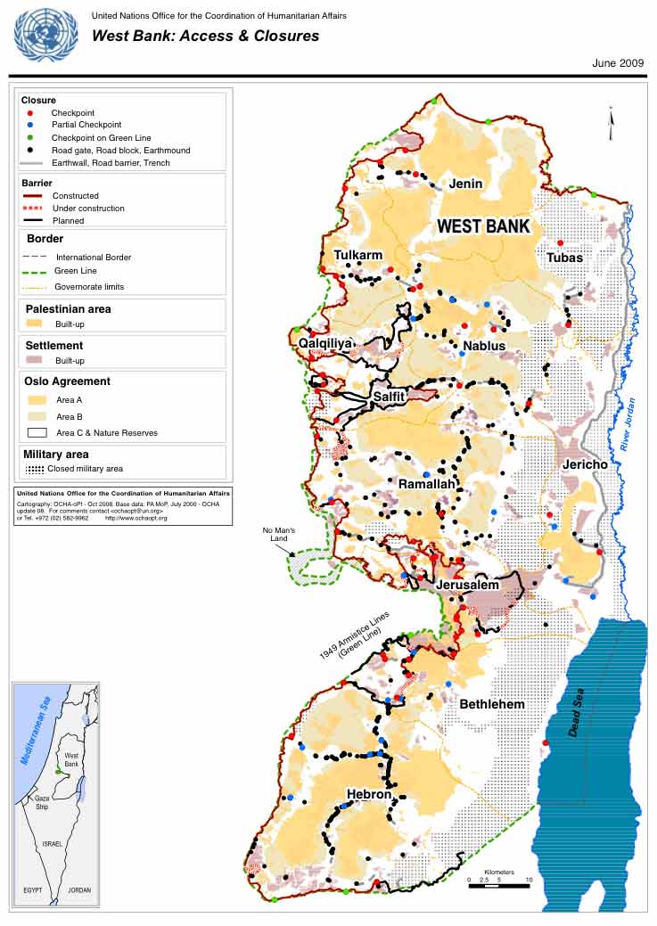
The World Bank Report (see posting World Bank report on Checkpoints and Barriers) has this very good map , taken from the UN Office for the Coordination of Humanitarian Affairs, highlighting problems of movement on the West Bank today. You can see a better quality version of the map on p.30 of the Report; and a much larger, finely-detailed version of the map, West Bank Closure Map , June 2009, on the OCHA website. This is best viewed very large, c.44″X18″.
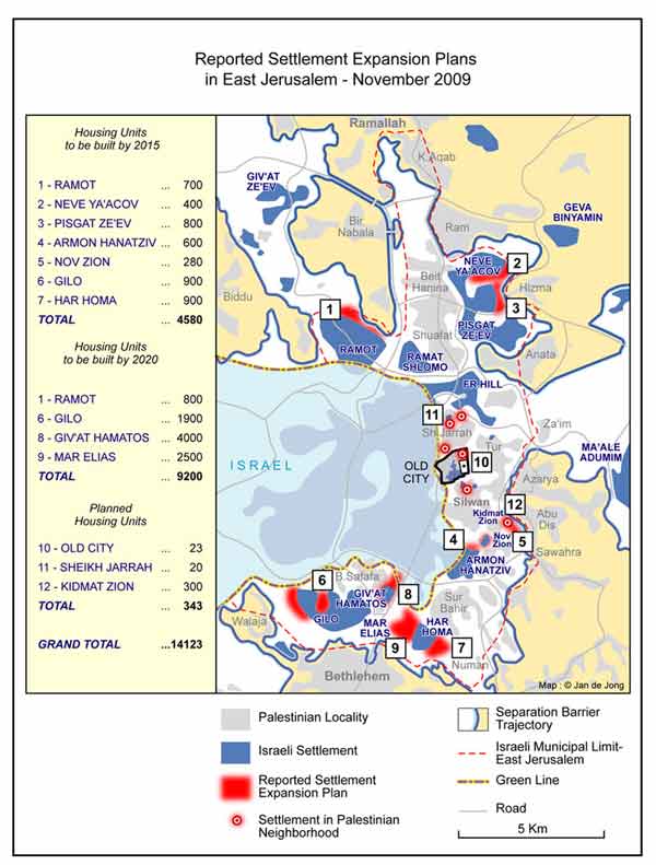
The Foundation for Middle East Peace Report on Israeli Settlement in the Occupied Territories November-December 2009 contained this map of East Jerusalem settlement plans as at November 2009:
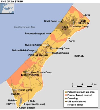
And while we’re at it, here is a good one of Gaza (the source will be acknowledged as soon as we can trace it…:


